Tag: Washington

Railroad Grade hike 14 August 2018

Railroad Grade hike 14 August 2018

Railroad Grade is a hike that skirts the lateral moraine of the Easton glacier of Mount Baker. This was my first hike with the SnoKing Happy Hikers group; my friend Brenda introduced me to this fun group.  The route starts with a walk in the woods and then a stream crossing on the trail to Park Butte. Luckily, the bridge was in place! After a few miles of walking, there’s an intersection; we turned upward on Railroad Grade. After about a mile of climbing, we took a side trail to the shaded High Camp area where I had nice lunch with Carol, Brenda and Ed.  We saw lots of nature: marmots, butterflies and lots of intriguing plants.

Route20180814
Route up Railroad Grade (purple) recorded by Gaia navigation app, plotted using CalTopo
OLYMPUS DIGITAL CAMERA
Happy Hikers ascending Railroad Grade
OLYMPUS DIGITAL CAMERA
Siesta view of Mount Baker from High Camp

After lunch and a siesta, Brenda and I continued up to the trail to the climbers camp at 5800 feet. We explored this alpine, rocky area. We scrambled up the rocks alongside the glacier; I eventually went up to about 6400 feet while Brenda decided to stay a bit lower. We saw lots of climbers, many of them practicing climbing skills on Easton glacier. After a few hours up high, we descended down to the high camp area for dinner. We then decided to walk out. We had a little navigation challenge after crossing the bridge but after a few minutes we spotted the trail into the woods and out to the car. This was a great first hike with the Happy Hikers,  a group I hope to do many more hikes with.

As I often do, I made a number of naturalist observationsiNat20180814

Alpine Lakes Grand Tour 2-7 August 2018

The best challenges help one grow physically, mentally, and emotionally.  The Alpine Lakes Grand Tour challenged me in all these dimensions. My friends Linda, Roger and I set out to do this tour from the Snow Lake trailhead near Snoqualmie Pass to the Snow Lake trailhead near Leavenworth. We estimated this as a 134 km (83 mile) hike, including about 31 km (19 miles) through the Enchantments region of the Alpine Lakes Wilderness  of Washington state. The elevation gain was 7,897 meters (25,910 feet) and elevation loss was 7,555 meters (24,787 feet)

IMG_20180807_082754z

We started this trip at 8 AM on Thursday 2 August and finished at 1215 AM on 8 August; a total time of 136 hours and 15 minutes. We originally planned this as a 5 day trip, about half way through we needed to add an extra day.

AlpineLakeGTroute
Alpine Grand Lakes Tour route (link to CalTopo map)

Daily Itinerary and highlights

  1.   20.6 km (12.8 mi)  Gain 1,053 m (3,455 ft)  Loss 1,151 m (3,776 ft)
    (Snow Lake, camp at Hardscrabble Creek)
  2.   20.1 km (12.5 mi)  Gain   955 m (3,133 ft)  Loss 1,092 m (3,583 ft)
    (bushwhack to Dutch Miller Gap, Lake Ivanhoe, camp on PCT above Waptus Lake)
  3.   21.5 km (13.4 mi)  Gain   898 m (2,946 ft)  Loss    943 m (3,094 ft)
    (Cathedral Pass, camp at Paddy Go Easy trailhead)
  4.   23.4 km (14.5 mi)  Gain  1,335 m (4,380 ft)  Loss 1,703 m (5,587 ft)
    (Paddy Go Easy pass, Meadow creek trail, Jack Ridge, camp at Trout Lake)
  5.   18.1 km (11.2 mi)  Gain  1,377 m (4,518 ft)  Loss 1,019 m (3,343 ft)
    (Windy Pass, camp mear Stuart Colchuck trailhead)
  6.   30.3 km (18.8 mi)  Gain  2,279 m (7,477 ft)  Loss 1,647 m (5,404 ft)
    (Asgaard Pass, Enchantments upper basin)
    Total stats
    134 km (83.3 mi)  Gain  7,897 m (25,909 ft)  Loss 7,555 m (24,787 ft)

Physically, this was a challenging backpacking trip.  There were lots of up and down.  (I’ll add a map and elevation profile once I process my GPS recordings.)  The first two days, I was experiencing nausea and fatigue, these were side effects of receiving a shingles vaccination the day before we started the trio. Also, my backpacking style is old school with almost no ultralight equipment.  I started out with a pack weight of 18 kg (39 pounds).

IMG_20180808_113006

One big lesson learned is to convert myself to ultralight backpacking. Lucky for me Roger and Linda are experts that can help me.

Mentally, this trip let me explore the flora and fauna of the Cascade mountains. The more I observe, the more I want to know.  This quote is often on my mind: “Each one of us adds a little to our understanding of Nature, and from all the facts assembled arises a certain grandeur.” – Aristotle as quoted by Bradford Washburn.

IMG_20180807_135820

IMG_20180805_093943
Shasta Fern (Polystichum lemmonii) on Paddy Go Easy Pass

Emotionally, there were some ups and downs for me. The first couple of days I felt awful, seriously thought of turning around and walking back out.  I think my ultrarunning experience gave me some added emotional resilience to keep going.  Also, when we decided we needed another day on the trail, there were some challenges communication the delay to my wife. Eventually, I was pretty certain I got a text message out. Also, I asked a couple of folks driving away from  trailheads along the way to call her, happy to say that both of them did this!

There were some real ups as well, such as looking back from slogging up Asgaard Pass and seeing beautiful Colchuck Lake or sauntering trough the wildflowers on the Meadow Creek trail. It made me appreciate my place in the Universe.

IMG_20180807_125047
Colchuck Lake from Asgaard Pass
IMG_20180805_145530
wildflowers on the Meadow Creek trail

Many thanks to the  designer of this excellent 2018 UltraPedestrian Wilderness Challenge route  and for Linda and Roger putting up with my grumpiness when I was sick the first couple of days.


Easy Pass UPWC 28-29 July 2018

With a name like Easy Pass, it must be easy… perhaps in a relative sense.

Summary

On 28 July 2018 I set out with my friends Linda, Roger and Rob on my third UltraPedestrian Wilderness Challenge EasyPass.  We fastpacked the route, starting at Easy Pass trailhead and camping overnight at Junction camp. We finished the next day at Colonial Creek campground. My elapsed time was 28 hours 51 minutes. Overall, it was a wonderful 40 km trip, despite hot weather and a plethora of flies.

EasyPassTrack20180728
Easy Pass to Colonial Creek Route

Easy Pass route

Details

We set out from the Easy Pass trail at 8:01 AM on 28 July.

OLYMPUS DIGITAL CAMERA
Intrepid UltraPedestrians John, Linda, Roger and Rob

Our route up the Easy Pass Trail climbed up steeply for about 6 km, until we reached  2100 meter Easy Pass. Near the top, there was an observation camera from the Cascade Carnivores project; situated to look for wolverines, martens and other rare carnivores.

After a nice rest and a bit of exploring at Easy Pass, we headed down switchbacks  into Fischer Basin. During the day, I made more than 40 botanical observations.  This entire section had some spectacular views.

Had a nice brekky and some great views of the mountains.  Around 8 Am, we started descending down the Thunder Creek trail. The forest ecology during the descent was quite different and I made about 30 botanical observations on 29 July.

IMG_20180729_095759comp
Thunder Creek was raging
2018-07-28 11.26.20comp
Looking East from Easy Pass
2018-07-28 11.26.30comp
Looking West from Easy Pass

As we walked through the Fischer Creek basin we moved from alpine to  meadow and then forest ecosystems.

IMG_20180728_123114-COLLAGE
Fischer Basin alpine meadow descending from Easy Pass
IMG_20180728_135223-COLLAGE
Forest Ecosystem

About 2 km east of Junction Camp we encountered a gnarly section of trail. There was a poor run-out if one should slip and the trail was eroding as we walked on it. Looking back, we light have been better to climb up and around this segment.

IMG_20180728_174818.jpg

We reached Junction Camp, having walked about 23 km from the Easy Pass trailhead. Along the way, we took a number of breaks due to the heat. I didn’t bring a thermometer but I’d estimate it was more than 31 degrees. I had a leisurely dinner and a good nights rest. I borrowed a bear vault from the Parks Service to store my food.  (Concerned about bears and other creatures getting into my food).

OLYMPUS DIGITAL CAMERA

OLYMPUS DIGITAL CAMERA
Mountain View from Junction Camp, maybe Tricouni Peak, with hanging glacier?

Had a nice brekky and some great views of the mountains.  Around 8 Am, we started descending down the Thunder Creek trail. The forest ecology during the descent was quite different and I made about 30 botanical observations on 29 July.

IMG_20180729_101923-COLLAGE
Forest ecology on Thunder Creek trail

I was out at the Colonial Creek trailhead at 12:51 PM, elapsed time was 28 hours 51 minutes.  Overall, this was a great two day fastpack trip and another fun UltraPedestrian Wilderness Challenge. Not running allowed me to observe the ecology closely while enjoying the company of three excellent companions. Next UPWC trio is Alpine Lakes Grand Tour starting on 2 August 2018, 4 days after the Easy Pass challenge.

Lessons Learned

  1.  First time using Gaia app on my phone.  Gaia worked well and I was able to download .gpx and .kml files.
  2. Decided to use a bear vault, added several pounds of weight. My base weight was about 11 kg. without food and water. I am going to lighten up a bit for nest backpack.
  3. Brought a battery pack and was able to recharge my phone. Unfortunately, forgot the correct adapter for my camera so my photos were mostly lower quality cell phone images. I had been hoping to obtain some high quality macro images with my new Olympus TG-5 camera.
  4. Instant mashed potatoes are delicious.
  5. Made sure to keep drinking plenty of water with electrolytes, I felt great on this hike.
Loowit trail fast pack July 2017

Loowit trail fast pack July 2017

Getting ready

On Friday evening 14 July, I noticed I had a test from my friends Linda and Roger – they were asking if I wanted to do the 28 Mile Loowit trail around Mount St Helens the following day. I’d need to arrive at there house about nine hours later. I decided, sure, why not. My wife Mary Ellen was fine with this, although it confirmed her suspicions that I’m slightly crazy. I signed up for my first UltraPedestrian Wilderness Challenge.

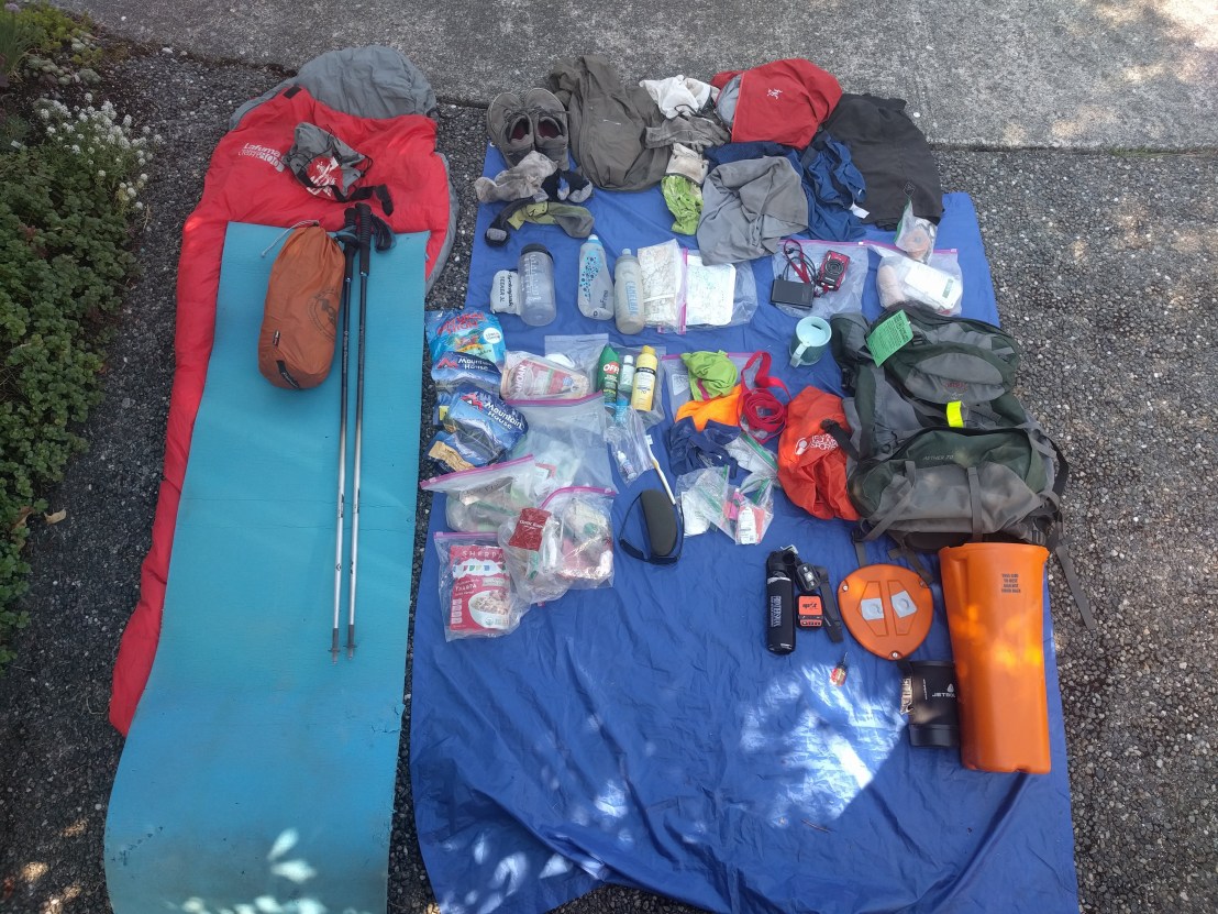
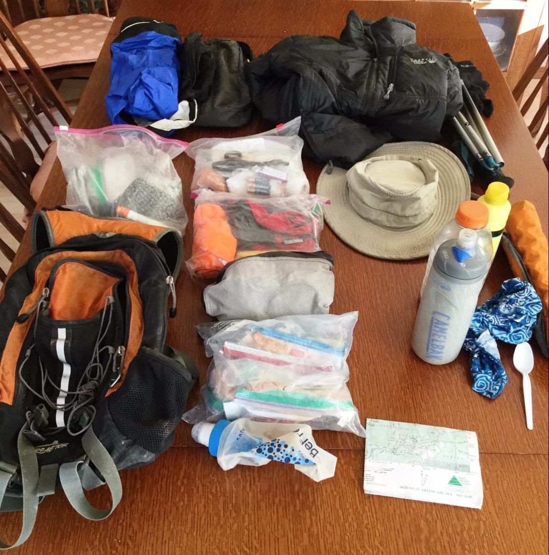
I have most gear ready to go… until I picked up my Salomon vest pack (about one year old) and had the shoulder strap fall apart. Well, time to dust off my old Gregory pack, 13 years old, but still functional. Carried my OR bivy sack on the bottom of the pack and hung a warmer jacket on the pack. Added a little extra food than I would normally carry on an all day run. Here’s my gear:

PackLoowit2

Our trip – Summary

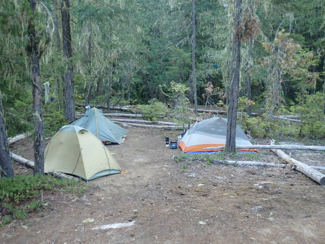
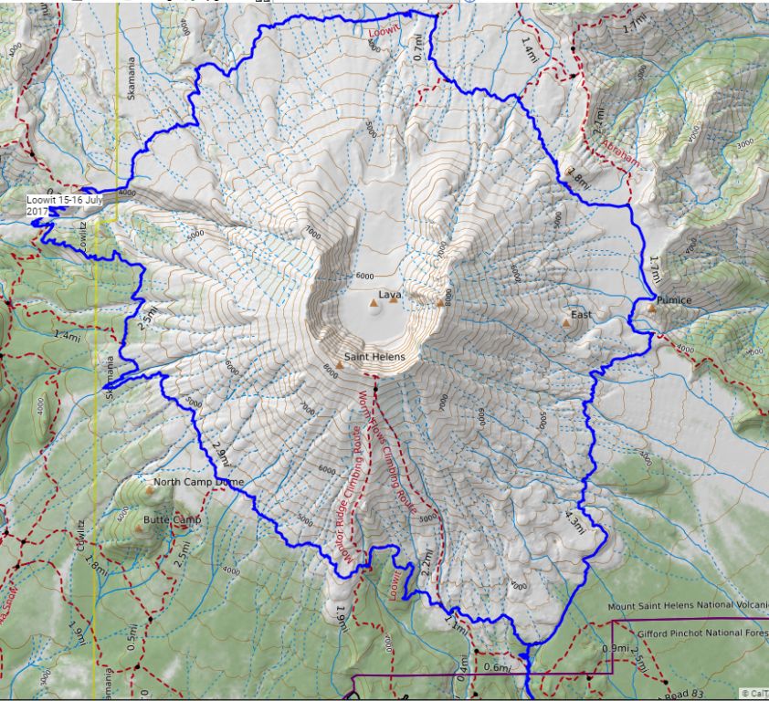
Linda, Roger, and I started out from the June Lake trail head at 8:16 AM Saturday. We started counterclockwise on the Loowit trail about 9:09 AM Saturday and completed the Loowit about 7:07 PM Sunday, about 33:58.  We were at the car about 7:54 PM.  We went about 20 miles the first day, camped just after crossing the South Toutle river, and hiked 12 miles the second day. There were a few technical challenges, most interesting was entering, crossing and leaving the South Toutle river. I liked these challenges, Linda gave me a new name: Pumice Dancer. Here is our route, using a GPX file that Roger created:

LoowitTrack

Many thanks to my ultrarunning mentors Roger Johnson and Jeff Wright, along with fast packing mentoring from Linda.   Really appreciate the UltraPedestrian Wilderness Challenge community for advice and encouragement.

Trip – Lessons Learned

What went well

  • UltraPedestrian Wilderness Challenges are fun and challenging
  • Fast packing worked out pretty well
  • Have gear ready to go is nice, including extra gear
  • No stove was no problem for an overnight

Areas to improve

  • Need to obtain and learn to use a GPS unit (in addition to map and compass)
  • Should have worn running tights for evening and morning
  • Didn’t need to have my bivy bag in its own zippered bag.
  • Had enough food but could have worked in a better variety

Trip – Some Details and Photos

I’m adding some more photos with brief descriptions, these are sequential from start to finish.

Day 1

IMG_20170715_111306
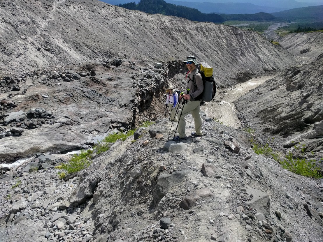
Linda and Roger at our first major channel crossing, we did quite a few of these. I earned the name Pumice Dancer from Linda for my love of these…

IMG_20170715_113233
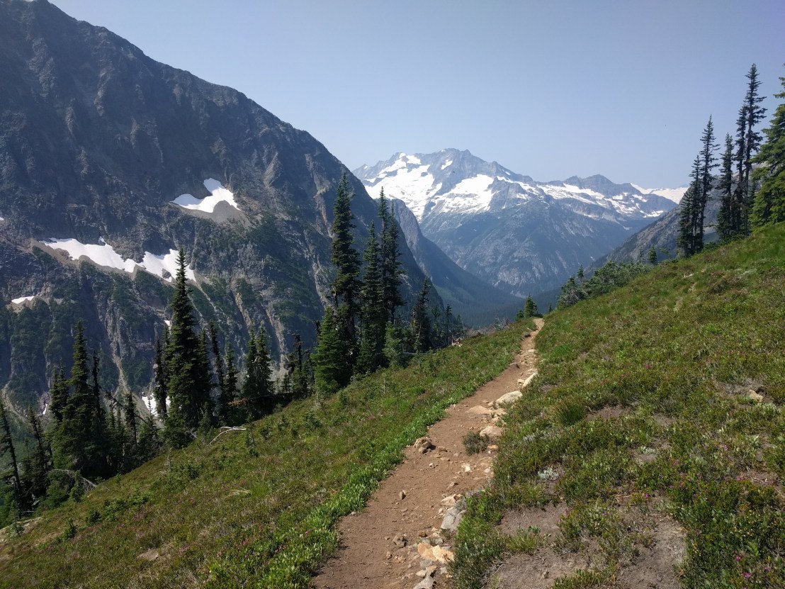
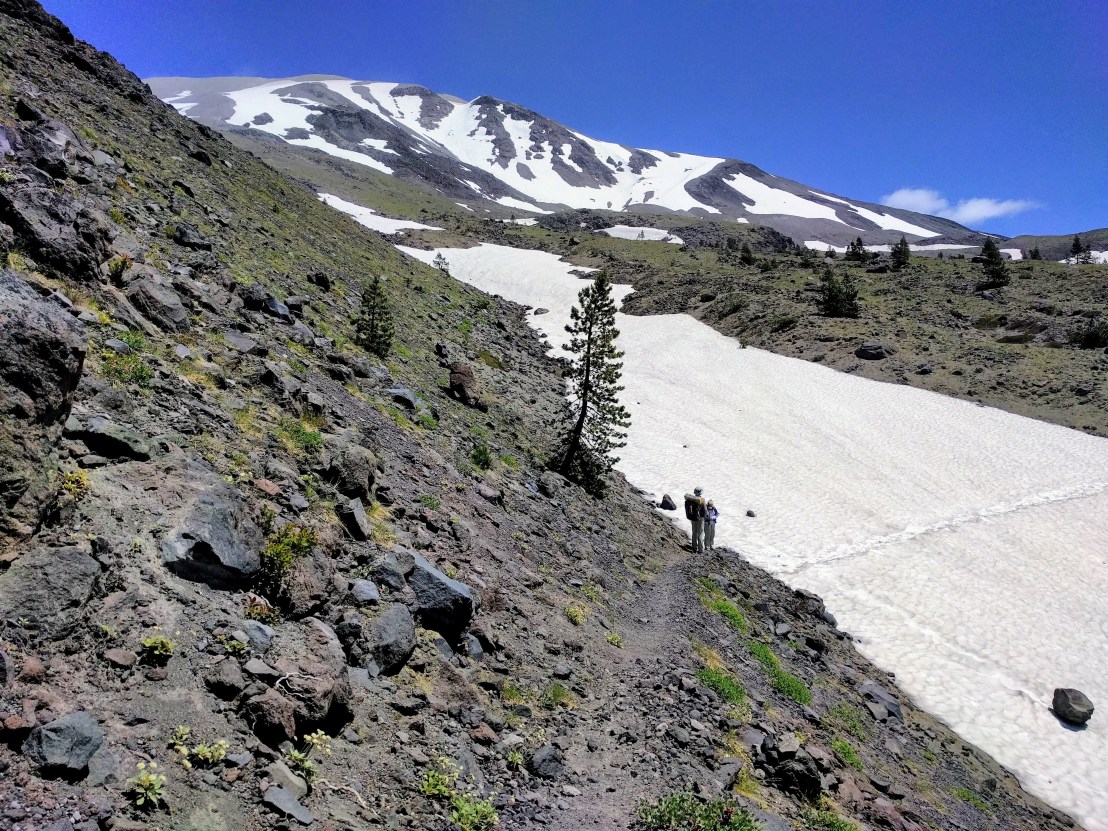
Still some snow left on the Loowit Trail but nothing too bad.

IMG_20170715_123414_1
Myself, Linda, and Roger on the dry east side of Mount St Helens. We had great weather as we circled the volcano.

IMG_20170715_140233
Climbing up to Windy Pass, Mount Adams in the background. We had great views of Adams and Rainier throughout the day.

IMG_20170715_152518
First view of Spirit Lake. On the left side of the lake is Harry’s Ridge, which I hiked two days before. I remember looking out from Harry’s Ridge thinking: “Boy, it would be fun to hike around Mount St Helens.” Here I was doing it two days later, thanks to Linda and Roger.

IMG_20170715_161925
In the blast zone…

IMG_20170715_205505
Ready to cross the South Fork Toutle river, near the end of a great day.

Day 2

IMG_20170716_115739
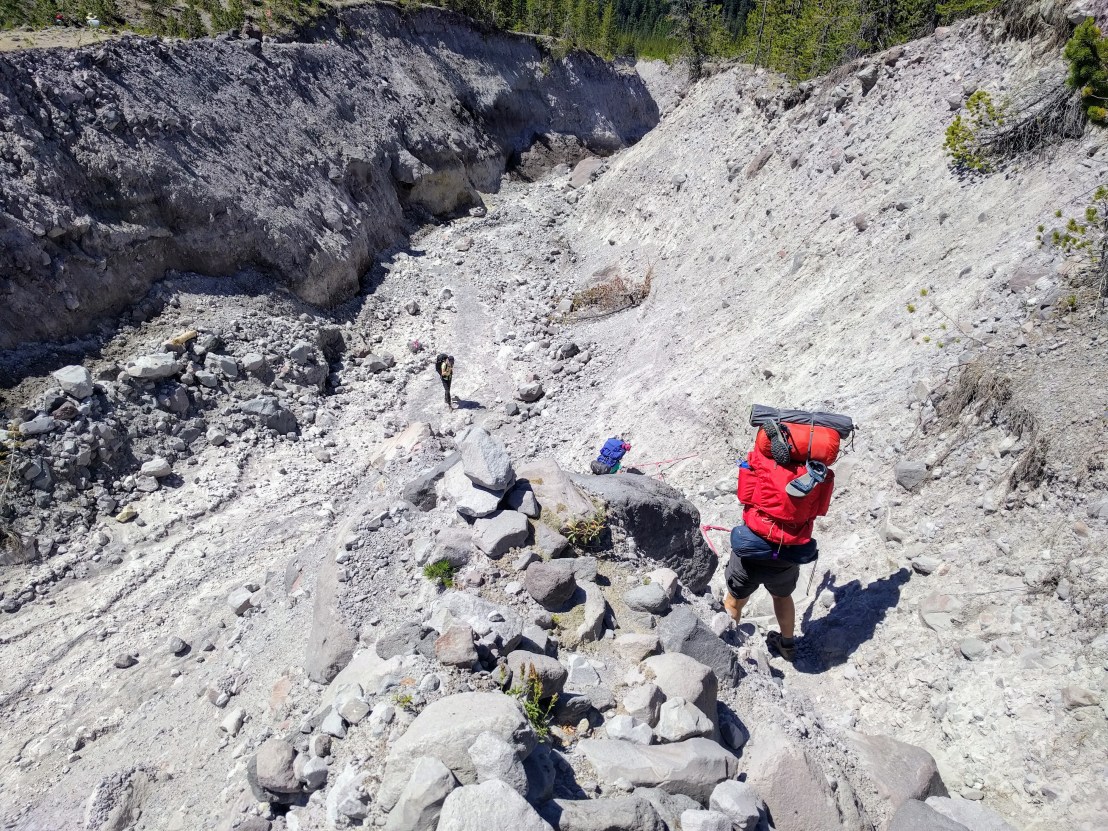
We had to use ropes that were installed four times, they were very useful.

IMG_20170716_130753
No words required…

IMG_20170716_135030
We ran into runners training for the Volcanic 50K race on 5 August.  They are part of the Go Beyond Racing group and I managed to get some good photos to them. I volunteering to carry water up to the Ape canyon aid station with some of them on 29 July.

IMG_20170716_180741
Rock hopping time… I liked this for some crazy reason.

IMG_20170716_182010
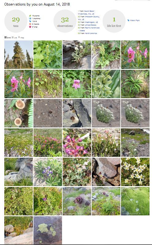
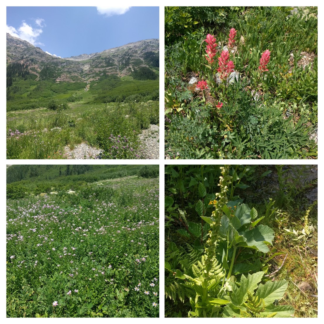
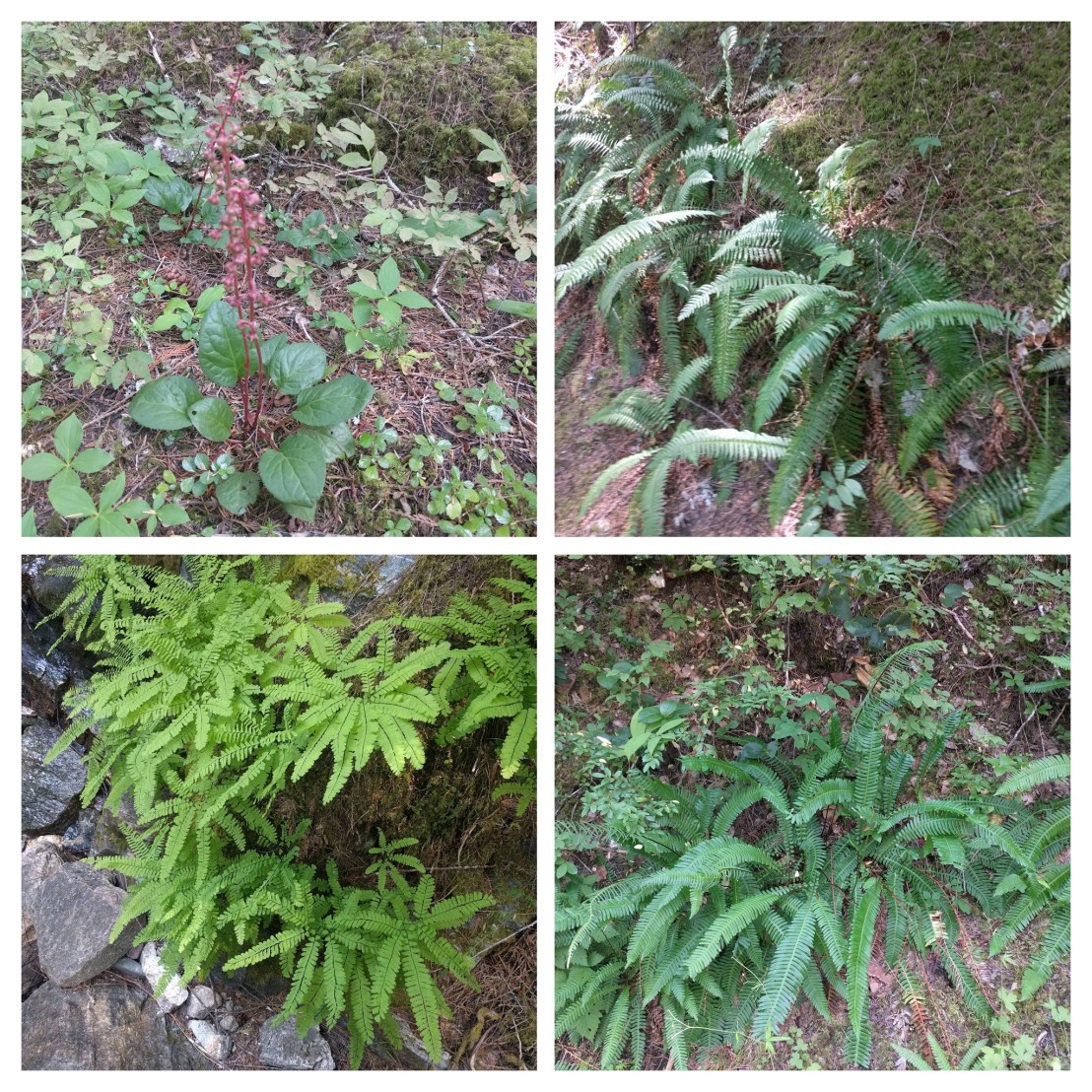
Made lots of botanical observations (that will be a separate post). This is my favorite, bluebells (Campanula rotundifolia) which I observed only on these south side rocks.